
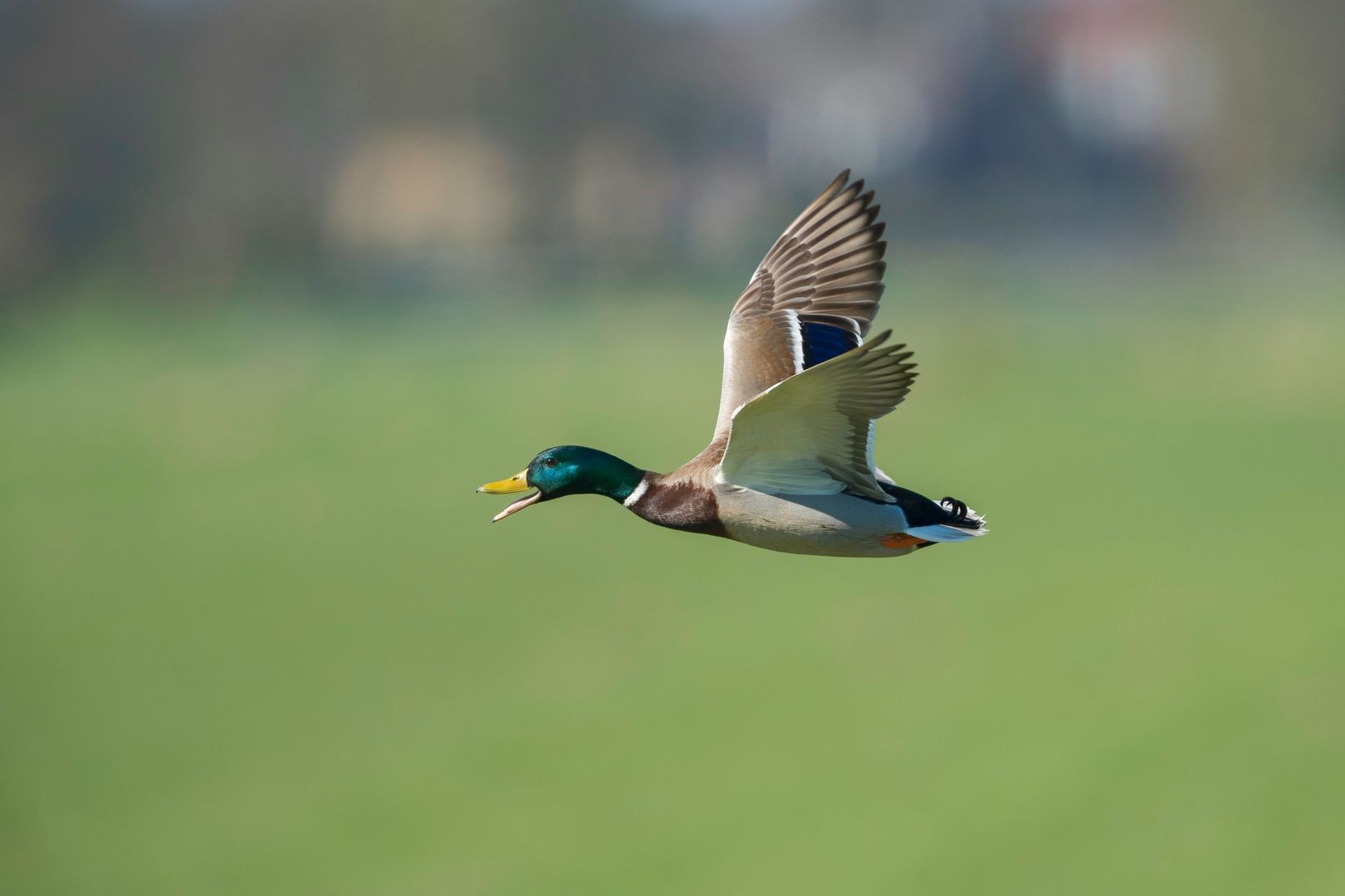
Every fall millions of ducks and geese leave the north on a schedule that's part biology and part weather.
The good news is that the migration of waterfowl is one of the easiest migrations to actually follow. The birds are big, they travel in obvious flocks, and an entire network of biologists, refuges, and hunters is counting them every week and posting the results.
What Is Waterfowl Migration?
Most North American ducks and geese breed in the north and winter in the south, and the trip between the two is the migration of waterfowl. Delta Waterfowl's migration explainer says southward migration "tends to begin in September and can really gain volume and velocity in October and November," and that some birds travel up to 2,500 miles while others breed right where they winter.
A huge share of these birds start in the same place. Delta Waterfowl estimates that up to 70 percent of the ducks hatched in North America begin life in the prairie pothole region, the wetland-speckled grasslands of the northern Great Plains and Canadian prairies. From there, they fan out south along routes that loosely follow the continent's big river valleys and coastlines.
Most birds migrate to have access to food year round, not because it's too cold.
Day length sets their internal clock, but weather tells them when to leave. Ducks, geese, and swans need open water to feed and roost, so when the north freezes, they leave.
The 4 Waterfowl Flyways
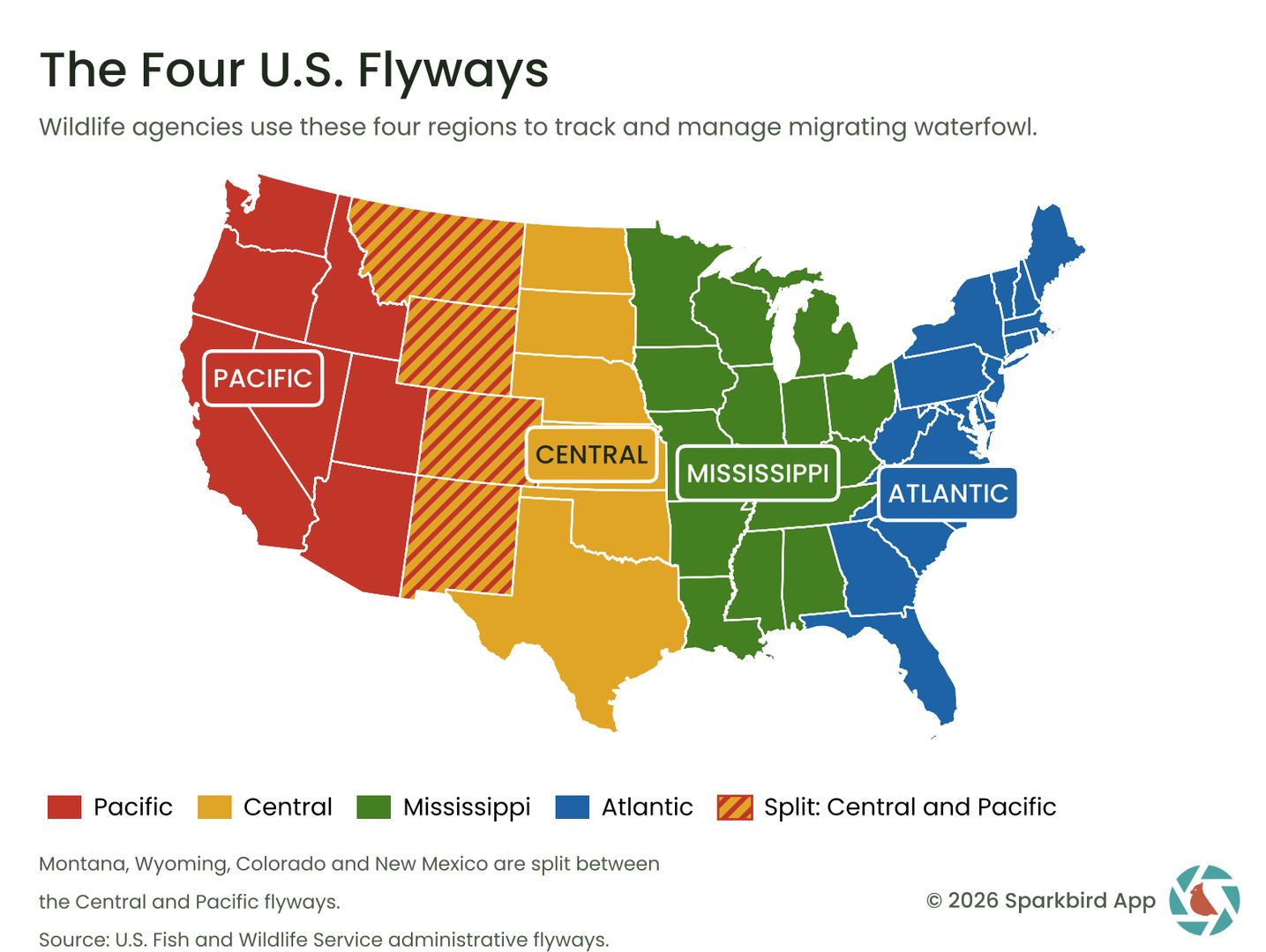
The U.S. Fish and Wildlife Service splits North America into four administrative flyways: Atlantic, Mississippi, Central, and Pacific. They're based on the routes birds use between breeding and wintering areas, but the lines on the map are management boundaries drawn along state lines, not velvet ropes. Ducks don't check which state they're in. (Neither do I on a road trip, if I'm honest.)
Each flyway has a Flyway Council of state and provincial wildlife agencies, advised by technical committees of biologists who review population data and recommend how birds and habitat should be managed. The Central Flyway was established in 1948, and the Mississippi Flyway Council organized in 1952. It's the flyway or the highway, and the highway has worse wetlands.
Atlantic Flyway
The Atlantic Flyway covers 17 eastern states from Maine to Florida, plus eastern Canada, Puerto Rico, and the U.S. Virgin Islands. Its waterfowl lean coastal: black ducks, scaup, brant, and Canada geese spread across salt marshes, bays, and tidal flats. At Delaware's Bombay Hook National Wildlife Refuge, large numbers of Canada and snow geese arrive in October, and the refuge lists November as the peak of fall waterfowl migration.
Mississippi Flyway
The Mississippi Flyway includes 14 states from Minnesota, Wisconsin, and Michigan down to Louisiana, Mississippi, and Alabama, plus Saskatchewan, Manitoba, and Ontario. This is mallard country. Ducks Unlimited calls the region the continent's most important wintering habitat for mallards and wood ducks, and notes that Louisiana's Catahoula Lake alone winters about 15 percent of North America's canvasbacks.
Central Flyway
The Central Flyway runs through the Great Plains: Montana, Wyoming, Colorado, New Mexico, Texas, Oklahoma, Kansas, Nebraska, and both Dakotas, plus Alberta, Saskatchewan, and the Northwest Territories. Central Flyway ducks include pintails, teal, and mallards fresh off the prairie potholes, and the flyway also carries snow geese and sandhill cranes south to New Mexico and the Texas coast.
- If you're in the Lone Star State, our guide to fall migration in Texas covers where to stand.
Pacific Flyway
The Pacific Flyway covers Alaska, Washington, Oregon, California, Idaho, Nevada, Utah, Arizona, and the parts of Colorado, Montana, New Mexico, and Wyoming west of the Continental Divide. Its heart is California's Klamath Basin and Central Valley. Lower Klamath National Wildlife Refuge, established by Theodore Roosevelt in 1908 as the nation's first waterfowl refuge, says an estimated 80 percent of the flyway's migrating waterfowl pass through the Klamath Basin each spring and fall.
When Do Waterfowl Migrate? Timing by Region and Freeze-Up
Waterfowl don't leave all at once. Think of it as a staggered checkout at a very large hotel.
Early fall (August to September): The early birds are teal and pintails. Blue-winged Teal are among the first ducks south, and at California's Sacramento National Wildlife Refuge, Northern Pintails can arrive as early as mid-August, with white-fronted geese following in September.
Mid-fall (October to November): This is the main event. Snow and Ross's geese reach the Sacramento Valley in October, Atlantic Flyway refuges fill with geese, and duck numbers build fast across all four flyways. Like songbird migration, the biggest fall flights tend to follow cold fronts with north winds.
Late fall (late November to December): The hardy holdouts move last. Mallards and Canada geese stay as far north as open water allows, so their timing depends on ice, not the calendar. Ducks Unlimited scientist Dr. Scott Stephens told onX's duck migration report that mallards get pushed out of Saskatchewan and Manitoba when daytime highs sit at or below freezing and lows are in the 20s. The same piece cites a 2025 study of 414 GPS-tagged mallards that found half of all southward movement was finished by about November 17.
The rule of thumb is simple: watch the fronts, not the calendar. When a hard freeze hits the northern prairies, the ducks are about to show up somewhere south of it, and that somewhere might be your local reservoir.
For a deeper dive on who leaves when, read our guides to when ducks migrate and Canada goose migration. And if you want the whole season in one place, here's how birds travel during fall migration, from the first warblers to the last mallards.
 The Ultimate Guide to Fall Bird Migration in the U.SFall bird migration peaks mid-September to mid-October. Learn how it happens, which birds leave or stay, and how to watch it near you.(opens in a new tab)
Waterfowl Migration Map: How to Follow It Live
You don't have to guess where the birds are, because several free tools track waterfowl migration in close to real time.
Ducks Unlimited Migration Map
The Ducks Unlimited waterfowl migration map is the big one. Hunters, DU biologists, wildlife agencies, and field editors post reports on where ducks and geese are concentrating, and DU says the map drew more than 37,000 reports in a single season. It's free to view, and you can sign up for flyway-specific migration alerts, which DU says run to nearly 70 alerts a season with weather and habitat details. Yes, it's built for hunters. Birders are allowed to read it too, and it's very good.
Birdcast
The live migration maps show what radar is actually detecting from sunset to sunrise, as opposed to what was predicted. The live map updates every 10 minutes through the night. The Migration Dashboard let's you type in your county or state, pick a date, and get birds crossed this night, peak migration traffic, charted patterns, and expected nocturnal migrants.
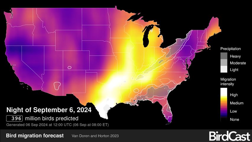 How to Use BirdCast to Predict Big Migration NightsHow to use BirdCast's forecast maps, live migration maps, county dashboard, and alerts to predict big migration nights and know when to go birding.(opens in a new tab)
eBird Status and Trends
Cornell's eBird Status and Trends turns birder checklists into animated abundance maps for individual species. Pull up a species like the Northern Pintail or Snow Goose, drag the timeline to October, and you'll watch the color bloom south across the continent. It's the closest thing to a weather radar for ducks, minus the anchor in a nice suit.
Mississippi Flyway Migration Report: The Illinois Aerial Survey
If you want a true Mississippi Flyway migration report, it's hard to beat the Illinois Natural History Survey's waterfowl aerial inventory. Biologists have flown it since 1948. Flights are generally scheduled every Monday from early September into early January, covering about 214 miles of the Illinois River and 272 miles of the central Mississippi River, and results go up on the Forbes Biological Station website as soon as each flight is done. It's a weekly duck census with a 78-year track record, which is more consistent than my gym attendance.
State Waterfowl Reports
Plenty of state wildlife agencies post their own counts. The Missouri Department of Conservation, for example, publishes waterfowl counts for its managed wetland areas along with wetland condition updates in late August and mid-October. Search your state's wildlife agency plus "waterfowl report" and you'll usually find something similar. Some refuges, like Loess Bluffs National Wildlife Refuge, also run weekly surveys from fall through spring.
Waterfowl Refuges to Visit This Fall
Reading the map is great. Standing in front of 100,000 geese is better. A few refuges that deliver:
- Sacramento National Wildlife Refuge, California (Pacific Flyway): Waterfowl are present September through April, and the refuge says numbers regularly peak at over 500,000 ducks and 250,000 geese, with November and December the busiest months. There's an auto tour, so you can bird with the heater on.
- Lower Klamath National Wildlife Refuge, California/Oregon (Pacific Flyway): The original waterfowl refuge, and a major fall stopover for most of the flyway's birds.
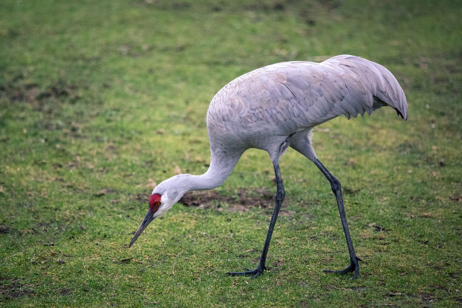
- Bosque del Apache National Wildlife Refuge, New Mexico (Central Flyway): The refuge says the greatest numbers of birds are present from early November to late January, when thousands of snow geese, Ross's geese, and sandhill cranes roost in its ponds. Get there before dawn for the mass takeoff.
- Loess Bluffs National Wildlife Refuge, Missouri: Its 10-mile auto tour is a classic. Local reporting puts typical fall numbers at 200,000 to 300,000 snow geese and more than 100,000 ducks, peaking in late November into early December, plus bald eagles waiting for an easy meal.
- Bombay Hook National Wildlife Refuge, Delaware (Atlantic Flyway): Tidal salt marsh, big October goose arrivals, and a November duck peak.
Two species deserve their own trip. Our guide to snow goose migration covers the flocks that look like a snow globe someone shook too hard, and our sandhill crane migration map covers the cranes that share many of the same refuges. And if you'd like to put names to the odder ducks you'll see out there, start with our guide to weird ducks and where to find them.
Leave the Marsh Cleaner Than You Found It
Fall refuges and boat ramps are busy places, and the most dangerous thing many waterfowl meet there is somebody's old fishing line.
The Missouri Department of Conservation warns that monofilament and fluorocarbon line "does not readily degrade," that wildlife gets entangled and killed in it, and that its agents have found dead birds hanging 10 or 15 feet up in trees after getting caught in abandoned line.
So pack it in, pack it out, and pick up a piece of trash that isn't yours on the way back to the car. There are usually monofilament recycling tubes at boat ramps. My cousin and I both keep trash grabbers and trash bags in our cars for this reason.
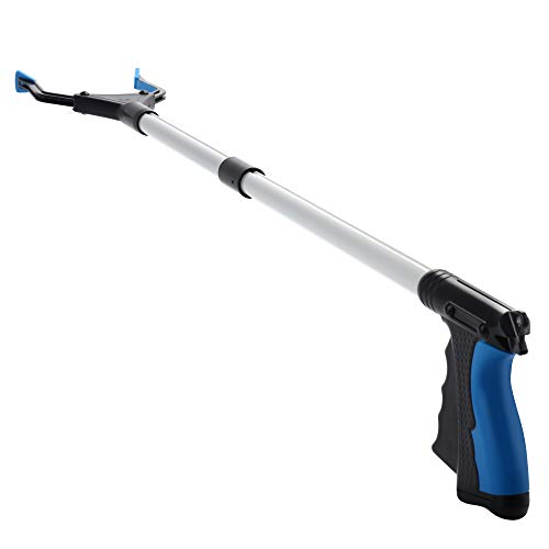
2026 Upgrade Grabber Reacher Tool, Foldable (Blue-32INCH) | Heavy Duty(Up To 12LBs), Trash Pick Up, Extra Long Handy Claw, Non-Slip Grip For Elderly, Mobility Aid
ZAYAD
Frequently Asked Questions
Is there a live waterfowl migration map?
Yes. The Ducks Unlimited Migration Map is free to view and updated with reports from hunters and biologists all season, and eBird's Status and Trends maps show weekly abundance for individual species.
Which flyway is Missouri in?
Missouri is in the Mississippi Flyway, along with states like Illinois, Arkansas, Iowa, Minnesota, and Louisiana. The neighboring Central Flyway starts at Kansas and Nebraska to the west.
How far do waterfowl migrate?
It varies wildly. Some ducks breed right where they winter, while others travel up to 2,500 miles, according to Delta Waterfowl.
Where's the best place to watch waterfowl migration?
A national wildlife refuge with wetlands in November is your best bet. Sacramento, Lower Klamath, Bosque del Apache, Loess Bluffs, and Bombay Hook are all reliable, and many refuges have auto tours. Bring your binoculars and ask your local birding group where the ducks are this week.
What waterfowl have you seen lately?
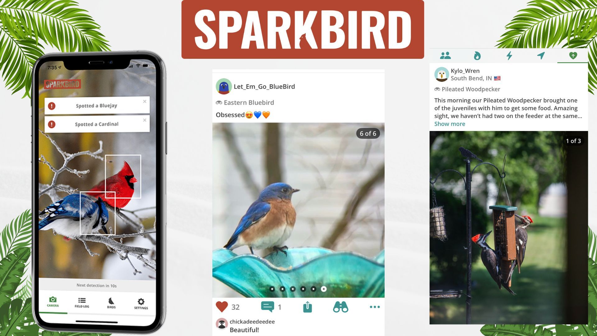
Tell us in the comments or through the Sparkbird App, available in the Apple App Store.
- Related: How to Use the Sparkbird App

No comments yet.